
Soil erosion
Amber Anderson
- Describe the impacts of erosion
- Outline the process of erosion
- Identify soil erosion indicators on the landscape
Process
Erosion is the removal of the upper layer of soil or topsoil. Since that layer tends to have higher organic matter and nutrients, erosion of the surface layer can cause significant negative effects on the soil for future crops as well as runoff. An inch of soil may take a thousand years to build, but could be removed in one rainstorm. Areas with shallow bedrock (R horizon) are particularly sensitive, as erosion may lead to a loss of the area for agriculture.
Erosion requires three main steps: detachment, transport, and deposition. We separate erosion into two major categories by the force that transports the soil particle.
Detachment
Not all soils or soil particles are equally susceptible to erosion. Sand may be easy to pick up, but is heavier to carry, so tends to stay closer to the source. Clay is hard to detach, but once separated, can stay in the air or water column for significant periods of time. Silt is generally considered the most erodible particle, as it is both reasonable to detach and carry.
Well aggregated soils are also considered less erodible-since the force would have to either break up the strong aggregate, or transport the whole aggregate.
Transport by Wind
Transport by Water
Observe from the video:
- When does the water slow down?
- When does the water appear more dirty/less dirty?
- What do you notice about the plants/plant roots? (soybean plants in particular)
- What else do you notice?
In Iowa, water is considered the dominant eroding force, but this does not mean that wind erosion is not occurring.
The Daily Erosion Project is a model based upon the rainfall data received along with soil characteristics to estimate loss after a given storm. Find a watershed of interest and see how much soil they lost in a given storm.
Shapes
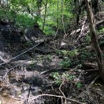
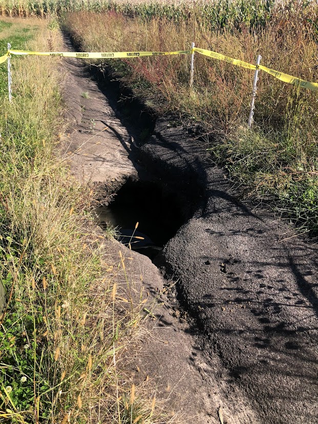
Gully
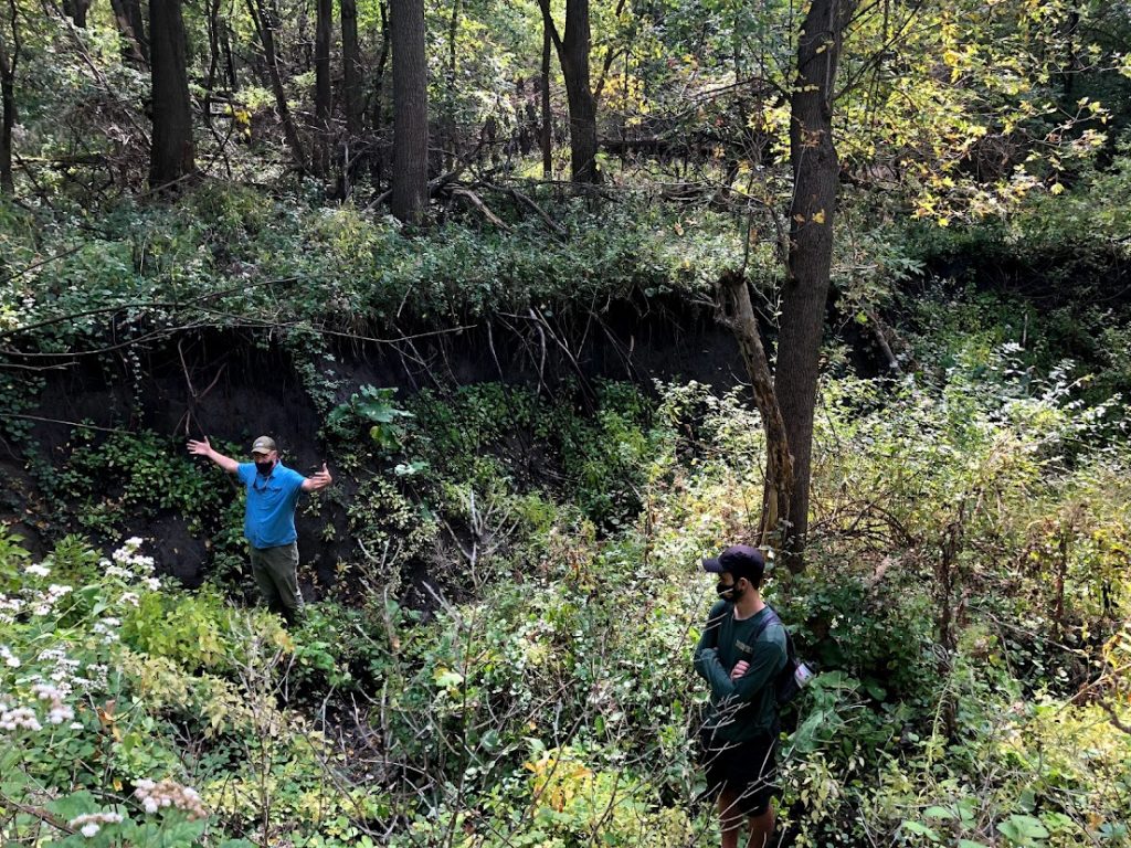
Most noticeable, gully erosion appears as large channels being cut into the ground, looking like a stream. These are impassable with equipment due to size. If not stabilized, water plunging down the wall will continue to move up the hillslope. It is easiest to deal with before this point, but controlling water as high up on the slope as is feasible. Simply filling the gully with sediment or rock will not solve the issue.
-
- Uphill from the previous gully picture, this shows the slope and how the cut has progressed up the hill. Photo credit Amber Anderson
-
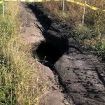
- Gully forming on a farm outside Ames. Photo Credit Amber Anderson
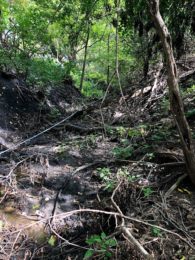
Rill
These are smaller channels, appearing more like fingers on the landscape. They can be destroyed by tillage-however, that is only destroying the evidence, not putting the soil back to the original condition. If the problem is ignored, future erosion will likely occur down the same path.
-
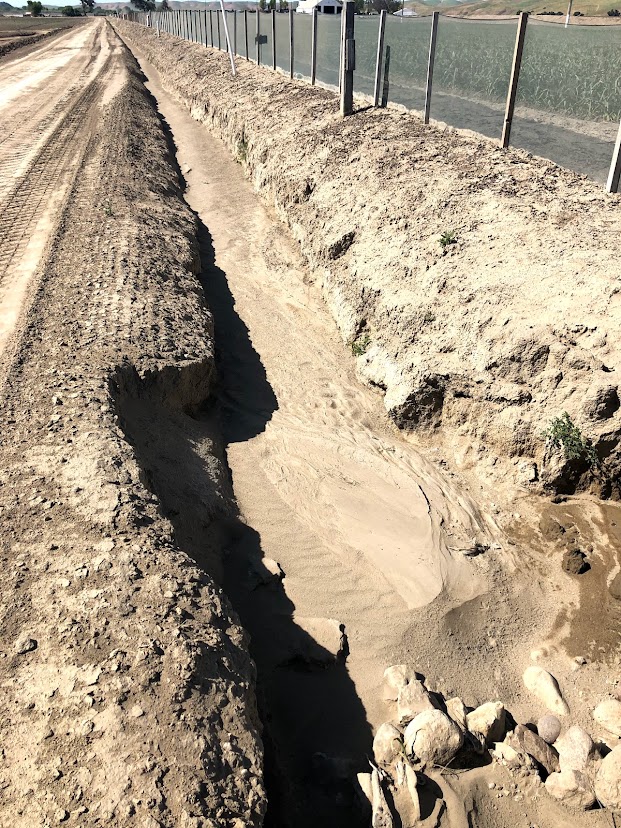
- Water erosion after land shaping in Southern California. This damage started as a smaller rill, and has continued to erode away material significantly increasing in size. Photo credit: Amber Anderson
-
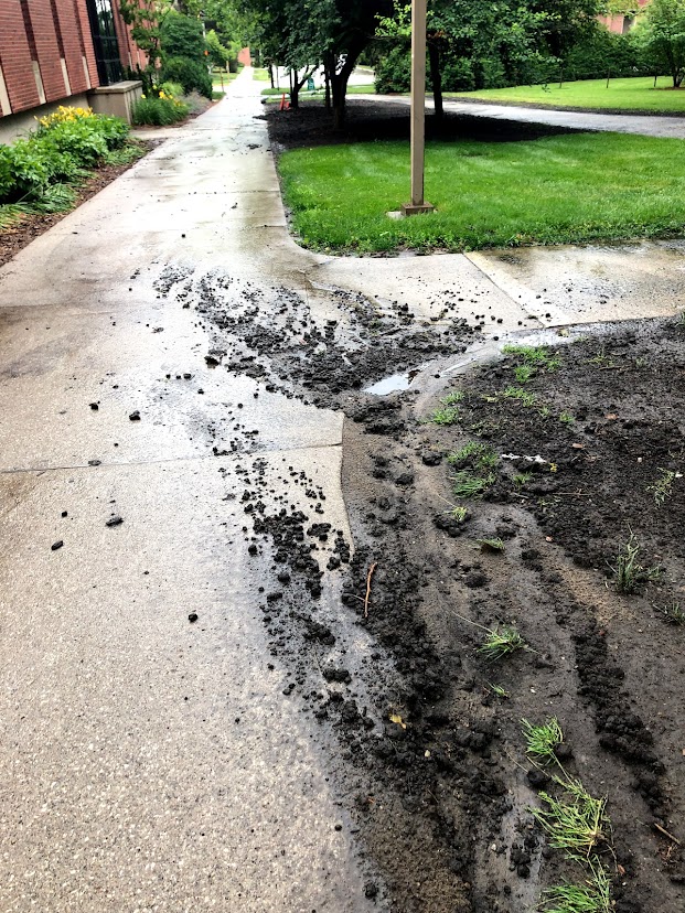
- Water erosion, forming rills, on ISU campus, south of Landscape Architecture and Hamilton Halls. Photo credit: Amber Anderson
-
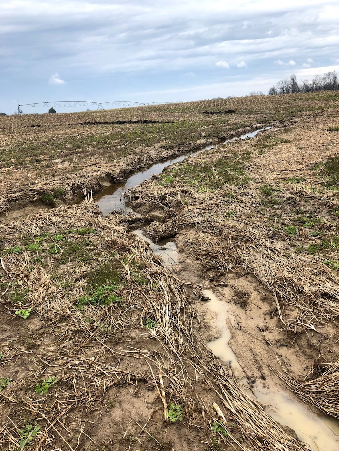
- Water erosion through a cultivated field, near Martin Tennessee in a particularly wet March. If not controlled, this will continue to erode and likely form a gully. Photo credit: Amber Anderson
Sheet
Least noticeable, this type of erosion takes a small layer equally off the soil surface.
Deposition
As “what goes up comes back down” so does detached and transported soil need to be deposited at some point. Sometimes this is only a few inches, or it could be hundreds of miles away. Additional damage or costs may result at that point, from filling in ditches or lakes, damaging human lungs, or covering other infrastructure-requiring removal or treatment costs as well as the loss to the source. In some cases, the previous A horizon is buried, as in the videos below:
- Erosion can occur in a variety of ways, but always includes detachment, transport, and deposition
- Erosion has significant negative impacts on soil properties and productivity, with potential costs of clean up as well.
